
Mastering Topographic Maps: Essential Navigation Tips
Mastering topographic maps is essential for safe and confident outdoor adventures. Understanding contour lines is the first step; they connect points of equal elevation. Closely spaced lines indicate steep terrain, while widely spaced lines represent gentle slopes. Deciphering map scales is crucial; use the legend and a compass edge to measure distances accurately. A map with a 1:24,000 scale offers detailed views of smaller areas. Essential tools for navigation include a Suunto compass and a backup map for trail safety. Apps like Gaia GPS can also assist with route planning. By honing these skills, you'll be well-equipped to navigate any type of terrain with ease. Explore more tips to become a proficient navigator and enjoy your outdoor excursions to the fullest.
Understanding Contour Lines
Understanding contour lines on a topographic map is crucial for accurately interpreting elevation and terrain shape. These lines connect points of equal height, revealing the landscape's form and elevation. The spacing between contour lines, called contour spacing, indicates the steepness of the terrain: closely spaced lines signify steep areas, while widely spaced lines suggest gentle slopes. Closed circles on the map represent mountain peaks, making it easier to identify the highest points. By mastering these elements, outdoor enthusiasts can navigate confidently, exploring rugged mountains and serene valleys. This knowledge empowers individuals to read the land effectively, ensuring precise and exhilarating journeys through diverse terrains.
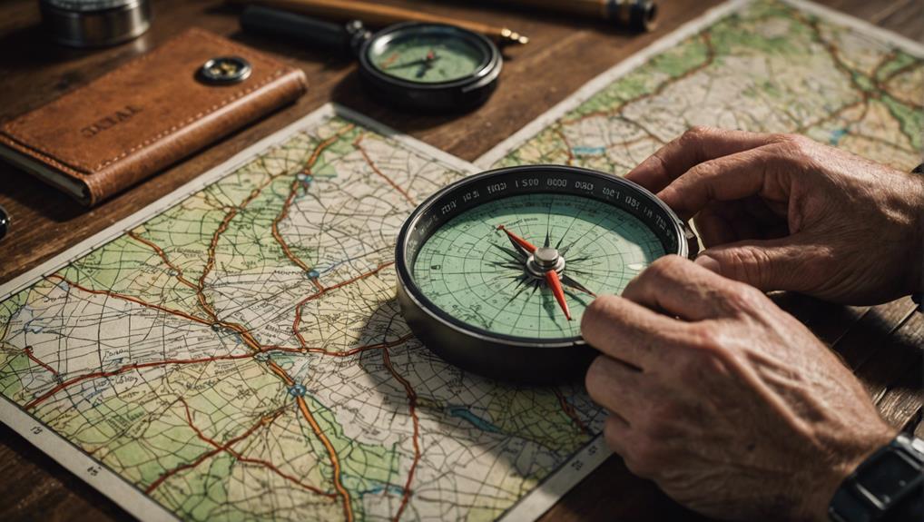
Decoding Map Scales
Understanding the scale of a topographic map is crucial for accurately measuring distances and navigating effectively. By interpreting map legends, you can grasp the relationship between map distances and real-world distances. Using distance scales enables you to determine the distances you need to travel.
Here are some essential points to remember:
- Refer to the map legend for scale information.
- Utilize the edge of a compass to measure distances directly on the map.
- Comprehend the ratio scale, such as 1:24,000, indicating that 1 inch on the map equals 24,000 inches in reality.
- Note that larger scale maps offer more detailed information for smaller areas.
Essential Navigation Tools
To navigate effectively and safely, it's crucial to have reliable navigation tools at hand. Begin with a detailed trail map to understand map colors and terrain features. A Suunto compass is essential for practicing fundamental navigation techniques and staying on course. Modern apps like Gaia GPS can assist with route planning and real-time tracking, but always carry a backup map and compass for trail safety in case of technology failure. Mastering the ability to read contours and plan routes enhances your confidence in exploring the outdoors. With the right tools and preparation, you can make your outdoor adventures both thrilling and safe.
Conclusion
Mastering the art of using topographic maps is crucial for anyone exploring unfamiliar terrain. Understanding contour lines, interpreting map scales, and utilizing essential navigation tools are vital skills that ensure successful navigation. By familiarizing themselves with these elements, outdoor enthusiasts and professionals can confidently navigate diverse landscapes. Proper preparation with the right gear further enhances the safety and success of any expedition. Embrace these tools and skills to effectively navigate the natural wonders of the world.